
Contour Map Exercises
I made a set of models to help Cubs understand how contour maps are constructed, and to help them visualise landforms from contour maps.
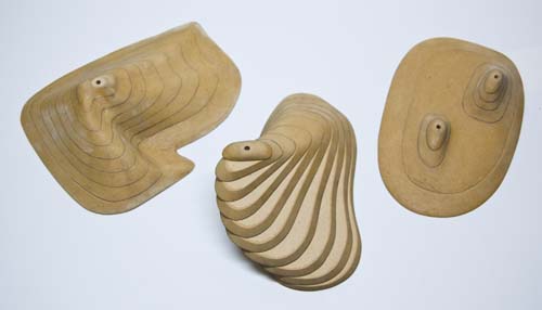
The models come apart in slices that can be traced onto grid paper. If each of the slices is traced in turn, we end up with a contour map, or plan. If we then extend trace lines from the plan into the elevation, as illustrated in the example, and join the resulting intersection points, we have the view we should see when we look side-on at the model we traced in the first place.
The quiz is just taken from the Book of Cub Scout Challenges, Gold Boomerang Test 5 (Outdoor Scouting).